0:39
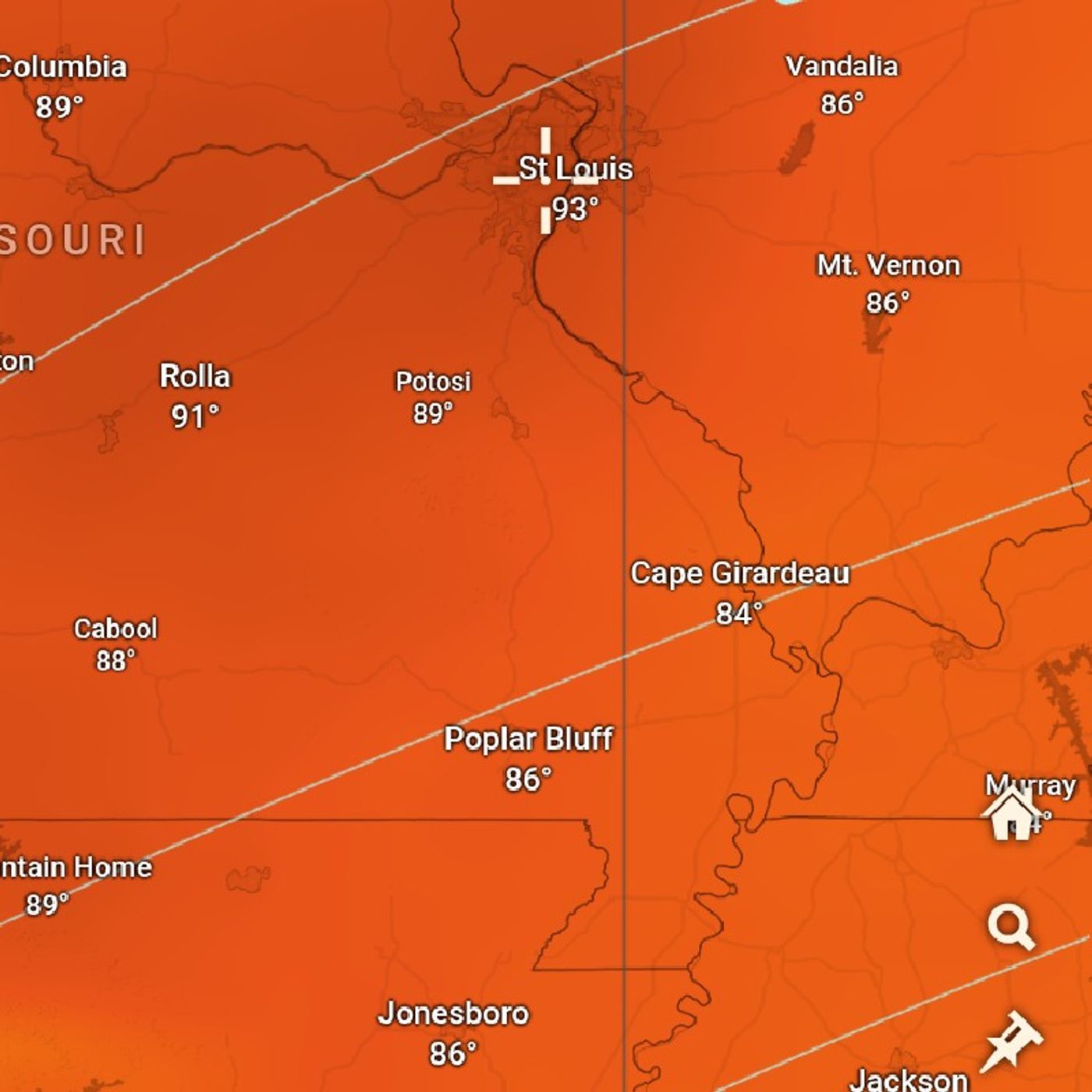
Good evening everyone. It is Sunday, October 10 And I just wanted to give a summary of the previous podcast which contained 34 minutes of weather. I'm going to try to get this done in five minutes 15 minutes max. On the weather map but the most significant thing that's taking place right now is a low pressure system that has dived from the northwest or actually this low pressure system was part of a piece of energy that went into reach to the Rockies split into two. One of them became a strong storm system that moved up into North Dakota and brought a severe weather outbreak yesterday. It's possible that that system is bringing some severe weather into northeast Minnesota and parts of Wisconsin this evening, but a more significant storm system, which also came out of this piece of Energy has moved into the southern Colorado area or into Kansas, the southeast part of this storm system is where we have the severe weather outbreak, Oklahoma, it really is the center of all of this severe weather there's a Tornado Watch in effect until 10 o'clock pm for much of Oklahoma and north Texas, North Central Texas, also some parts of Southeast West southeast Kansas and southwest Missouri and Western Oregon's also have a very good chance of seeing severe weather. The highest chance for tornadoes are going to be this evening and then the damaging the most damaging part of these storms is going to roll onto, it's gonna change over to damaging wind as we go through the night, there's a good chance that these thunderstorms which are hitting this right now are going to develop into a squall line later on tonight bringing damaging winds up to 80 miles per hour, possibly even 90 miles per hour in some locations Flash Flood Watch has also an effect for parts of Oklahoma where very heavy downpours is expected and that could cause flash flooding on the other hand, only one to two inches of rain of widespread rain is expected over there but, which is heavy rain but the flash flooding will likely be a result of rainfall accumulations that are higher than one to two inches, large hail to the size of baseballs is also a possibility with some of this severe weather one of the highest dangers with this situation right now is the fact that it's going to be occurring in the night, and that's always more dangerous situation and when these tornadoes occurred during the day the safest place to be would be in a basement away from windows that would be the safest place to sleep. If you are in one of those areas. This low pressure system then move on to the Great Lakes, tomorrow and severe, and the Ohio Valley that's going to be affected by the severe weather tomorrow, chances for severe weather aren't just a possibility there's also a possibility for tornadoes even in the Chicago area, but much less of a possibility than what has been happening in Oklahoma. But there is one thing, extra that's going to be happening in Chicago that is the storms are going to be moving really quickly 50 to 60 miles per hour, which means once a tornado warning is issued if it is issued, there will not be much time to prepare for the most likely damage severe threat in the Chicago area is going to be damaging wind, strong winds just above the surface, 50 to 60 miles per hour is what's going to be pushing these storms, but thunderstorms tend to bring winds down to the surface. So those are the types of winds that might be coming down to the surface whenever you have strong winds, there's always a chance for large deal as well. So there is a possible chance for severe weather for places like St. Louis, Missouri Chicago Illinois Detroit, Michigan, and Cedar Rapids, Michigan as well. And I am not sure about Indiana. I know Northwest Indiana and one would think this would include Indiana, but there was one map I saw in regards to something that excluded in northeast Indiana and I don't know if this is what it is.
4:45
Anyways, a cold front comes through as...
Become a supporter of this podcast:
https://www.spreaker.com/podcast/weather-with-enthusiasm--4911017/support.